Which Procore tools let me view digital image attachments in a map view?
Background
Many tools in the Procore web application incorporate an attachment viewer to provide users with the ability to upload file attachments associated with an item or object. For example, your project team might upload photos for your punch list items or to record an incident that occurred using the Daily Log tool's Accident Log. To learn more about the attachment viewer, see the Answer below.
Answer
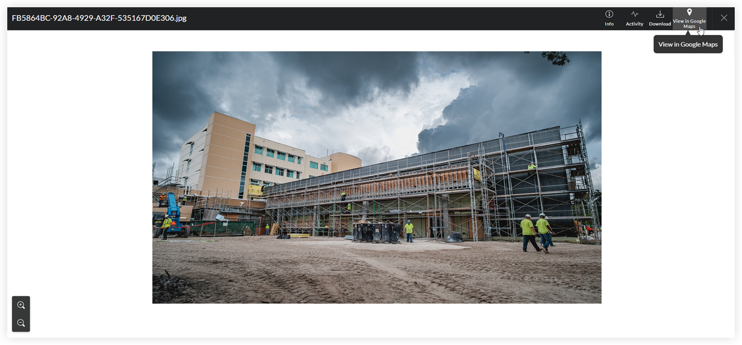
If an image attachment has a JPEG or PNG file format with Global Positioning System (GPS) coordinates, users can click View in Google Maps when viewing the attachment on supported tools in the Procore web application.
Note
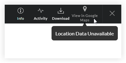
- If the digital image does NOT contain GPS coordinates, the 'View Google Maps' button is grayed out and unavailable.
- Most smartphone cameras have a built-in GPS function. When you take a photo, the camera automatically captures the GPS coordinates of the location where the image was taken. To learn how to adjust the GPS function on a camera, refer to the camera manufacturer's documentation.
Supported Tools
The View in Google Maps button detailed above is available for use in these Procore tools:
| Tool Name | Relevant Tutorial |
|---|---|
| Coordination Issues | View Coordination Issues |
| Correspondence | View a Correspondence Item |
| Custom Tools | N/A |
| Daily Log | View a Daily Log in the List View |
| Documents (Company Level) | View Documents in the Company Level Documents Tool |
| Documents (Project Level) | View Documents in the Project Level Documents Tool |
| Equipment (Legacy) (Company Level) | View a Company Level Equipment Entry |
| Equipment (Legacy) (Project Level) | View a Project Level Equipment Entry |
| Forms | View a Form |
| Incidents | View an Incident |
| Instructions | Create and Issue an Instruction |
| Inspections (Project Level) | View Project Level Inspections |
| Meetings | View a Meeting |
| Observations | View an Observation |
| Punch List | View Punch List Items |
| RFIs | View RFIs |
| Submittals | View a Submittal Package |
| Tasks | View a Task |