Procore Maps uses the location information from the photo, or photo attached to an item, to place it on a map automatically. This location information comes from the device's GPS. If the device's location services are off, this information won't be saved. Please note that this data can also be stripped by email or by some web browsers and the photo will be designated as “unmapped” with no latitude, longitude values. To map an unmapped item, see Add Item Pin to Map.
Why aren't my items showing up in the right location?
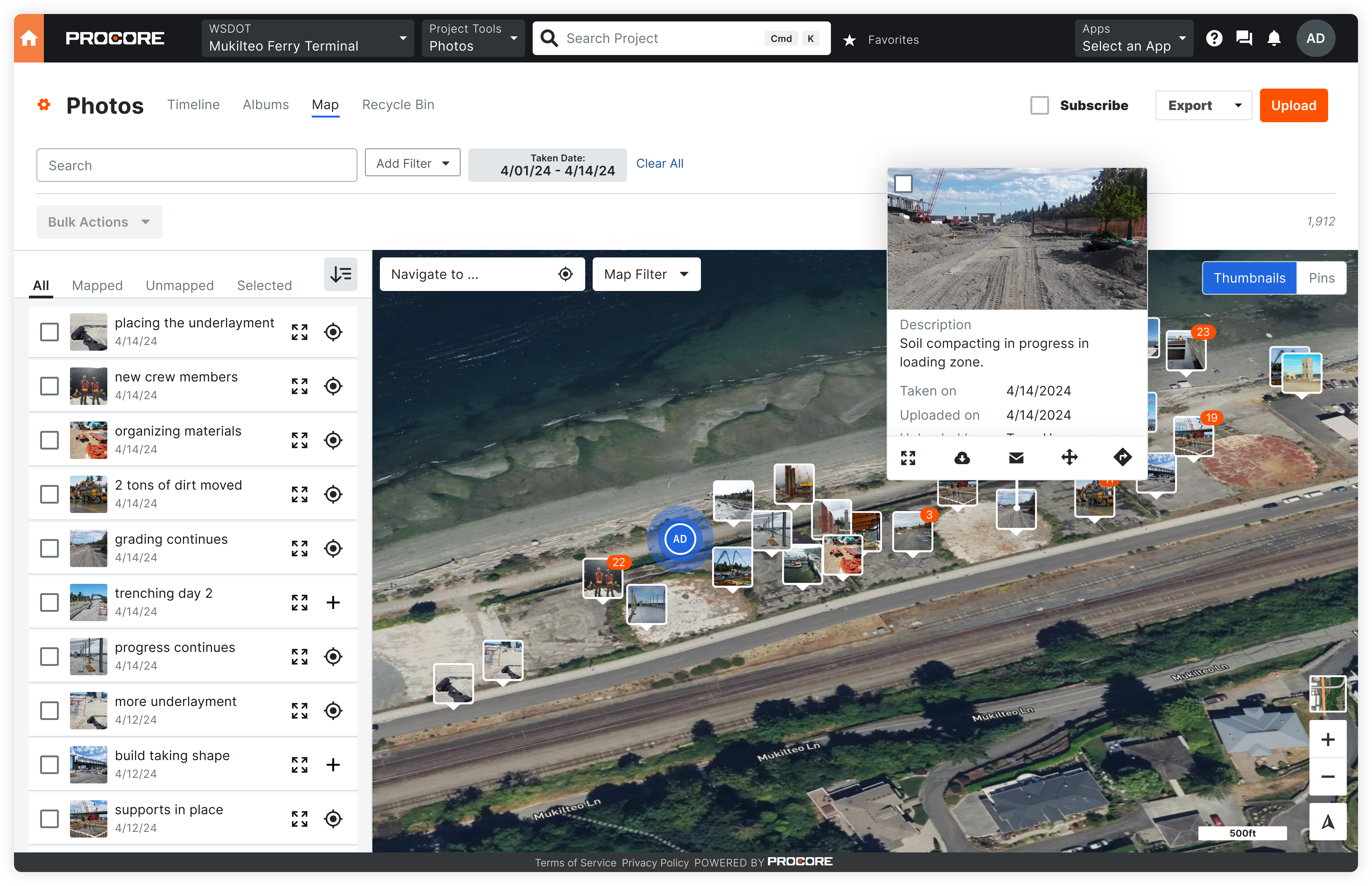
All photos appear on the map based on the location data in the photo. If the photos do not appear on the map, it is likely, that the photos do not contain location data. To confirm that your photos collect location data when you are capturing photos, you must enable location tracking on your device. See Android Location Data and iOS Location Data.
However, sometimes a mobile device's location services are inaccurate due to issues like lag in location syncing or poor geographic coverage. While Procore cannot improve your device's accuracy, you can purchase third-party devices to enhance it.
What is the best way to add photos to Procore so they appear on the map?
When creating items such as observations, inspections, and punch items, it's best to upload the photo from the device where the photo was taken, such as your smartphone. For third party devices, a direct copy from the camera to a photo app should maintain the necessary metadata.
When photos are transferred from a phone to a desktop, it's possible that the photo's metadata is removed, including the EXIF data needed to place the photo on the map.
Tip
- File format: Use JPEG format, as it usually retains most EXIF data compared to other image formats like PNG or GIF.
- Direct copy: When transferring photos from a camera to your computer, copy the files directly using your file explorer to retain EXIF data.
- Cloud storage settings: When using cloud storage services, select the 'original' quality option to retain EXIF data.
- Sharing as documents: If sending photos via email or messaging apps, attach them as documents instead of directly sharing images.
- Dedicated photo management software: Some specialized photo management software allows for EXIF data to remain intact during transfer.
Can I see mapped data on inactive projects?
Typically, yes. Any newly created items with photos that have EXIF data are automatically mapped on projects, regardless of project status.
However, if your project was inactive prior to Maps becoming generally available on January 22, 2025, your mapped data may not be available. If you need to see mapped data for these projects, please contact Support.